
We awoke on Sunday morning two weeks after arriving in the States to check that our very own RV was still parked outside Aunt Mavis’ house. Yep, all OK so we packed in the final supplies including some goodies and necessities that Mavis insisted we must take ‘just in case you may need it’. One of them is a lovely old patchwork quilt ‘for when the temperature gets milder up north’.
After checking the oil and coolant was all good, we connected the GPS purchased at Cosco earlier in the week to find that we have is Spanish version and we both went into a mild panic. We couldn’t understand a thing! However we knew that Cousin Mike had the same brand, so called him on the mobile to get clear instructions to convert it into American English. We then put in the address of the RV Park about 200 miles away only to have it say did not recognize it, so Wendy made up one that would be nearby, hopefully by the shortest route.
We were finally off into the blue yonder. We started out down freeways (6 lanes with traffic as thick as Gold Coast to Brisbane on a work day) and gradually moved on to more narrow, and even more narrow roads.
This was a bit nerve-wrecking for both of us and Johno was feeling pressure, driving on the other side of the road in a vehicle that’s 27ft long and 8ft wide. We also had to get used to the way they describe highways, byways, roads, off ramps, etc as they don’t talk refer to destinations but use numbers, something you might have picked up watching US television programs, i.e. interstate highway is called i140, the coastal highway is called the California 101, ….it’s mindboggling to say the least. Johno says it’s a good thing we can work as a team, he drives and the GPS and Wendy tell him where to go!
 |
| snow melts all the way down the mountains |
Once out of the city areas we are guided by the female American voice of our GPS (her name is Jill) into more rural landscape where we pass pistachio nut orchards and all sorts of small-crops, and in the distance we can see grasslands and mountains; really high mountains and “Is that snow up there???” It’s hard to comprehend because it about 85 degrees today.
Eventually we were on the road to Yosemite and although we were still about 50 miles away we could see changes all around us. Green trees, beautiful wildflowers everywhere. The roads were in good condition but narrow and windy. For probably 50 miles we drove between steep rocky mountains and the deep, full-flowing Merced ( pronounced mer-said) River. Around every bend there was another amazing scenic view, so pretty, so awesome and so different to what we had just driven through. The closer we got to Yosemite, the bigger the mountains, the wider and louder the river, running with dangerous rapids and the narrower the roads – my knuckles were white and Johno’s face was red.
 |
| The mighty Merced |
 |
| Spray from waterfalls |
We didn’t think the drive would be this stressful but then it got even more so. There had been a huge landslide, which covered the entire road about twenty feet high and ¼ mile long, and with nowhere to go, they had engineered a one-lane bridge (looked like it was made out of Meccano but felt much stronger) across the Merced onto a very narrow gravel road on the other side of the river.
About three miles along, there was another one of those bridges to put us back onto the i40 into El Portal which is where we stayed for three nights, while we explored Yosemite. By the way, we had to take the same trip back out of the park so it was good to have some recovery time.

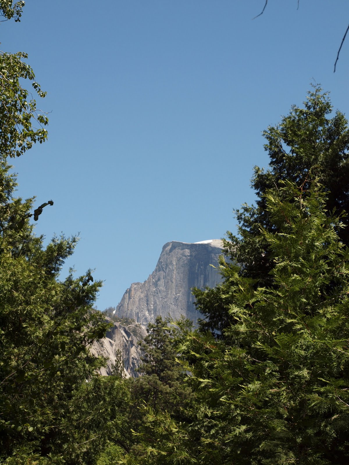
Now Yosemite is awesome even though we have been told, more than once, that it isn’t the best National Park we will visit over here.
Forget Dreamworld and Seaworld, this is God’s World.
Forget Dreamworld and Seaworld, this is God’s World.

We took a tour of the valley floor in an open-top trolley to get some sense of the place and our ranger-guide told us that there is a real danger out there of people getting caught DUI – yep that’s right – driving under the influence (of beauty) – so the National Parks have accommodated those drivers by putting ‘stop and look’ laybys everywhere.
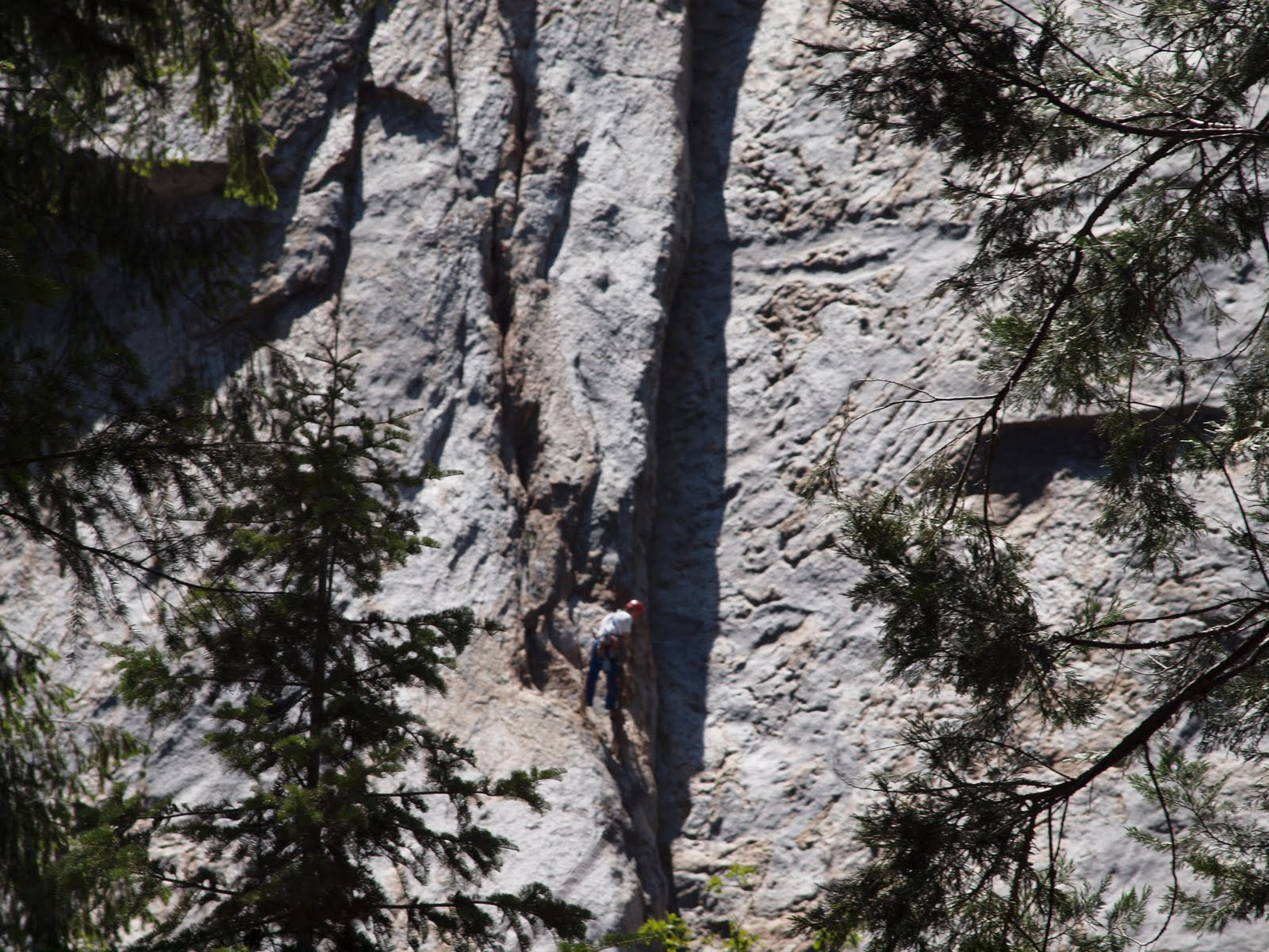 |
| Can you see the climber?? |
 The tour was extremely interesting and we learned about the Indian people who own the land and their traditional ways. We were also told that the timing of our visit was very unique as the summer had come very late and the snows were still melting. They expected the Merced to flood within the next 24 -36 hours, which would mean some closures until the waters (6,000 cubic feet per second for you Lismore readers) rushed further down river and the rapids slowed down.
Did I mention that the temperature was in the 90’s that day? So hot and yet while we were on the valley floor (walked for hours) it was quite comfortable – the decomposing forest floor and all that cold water created a natural cooling system.
It was while on the trolley tour that we met our first Aussie tourists, and now two weeks later they are the only ones we’ve met.
 |
| Yosetime Falls - Upper and Lower |
There are lots of waterfalls here but for us, the most impressive waterfall is Yosemite Falls – it is the highest in the park. It is close enough to walk to and there is one spot, on a viewing bridge, where you can feel the force of the water as it comes crashing down. It was unbelievable! We felt like we were in a huge summer storm with wild winds and stinging rain. Then we walked off the bridge along the path a little further. You could still here the water crashing behind you but the air was still and the creek nearby, just a trickling brook.
 |
| view from our campsite |
After another night camped by the Merced, under clear skies and the custodial Sierra Nevada, we drove back out to the i99 headed to Sacramento.
 |
| Merced River at el Portal |
 |
| Only bears we've seen so far - carved out of a whole tree trunk |
 |
| great pic Johno! |
 |
| yes - there are people up there!! |
 |
| lots of these bridges throughout the park |
 |
| Bridal Veil Falls |
 |
| Snow on the mountians |
 |
| Teepee in Indian village |
 |
| Tunnel through mountain at Yosmite |
No comments:
Post a Comment